Indices covers the static snapshots and averages, and Cycles looks into a desert’s rhythms to provide a guide for interventions. Fluxes constitute the precise tracking of thresholds, moving beyond passive observation to establish an architectural basis for a mobile, responsive approach, one sensitive to nuances rather than standardised across board.
This multi-scalar framework proposes integrating the synoptic gaze of orbital satellites with the high-fidelity pulse of ground-based networks to inform the new metrics for success, rooted in a desert’s inherent capacities. It distinguishes the presence of primary and secondary deserts, using data not to average out the lands but as part of a feedback loop serving as a medium for ecological reconciliation. This enables the Technosphere to change from being an extractive, administrative imposition into a restorative climatic interface, shifting away from merely recording desertification to actively combating it.
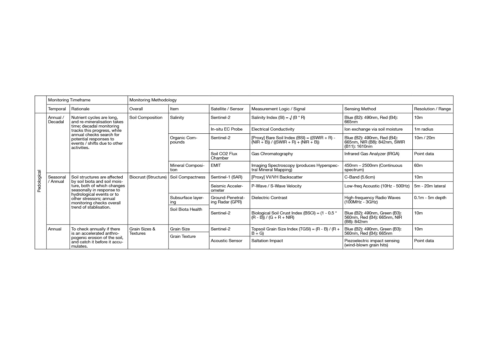
Pedological
To read the pedological connditions examines the soil composition, the biocrust structure, and the grains themselves. It involves a suite of satellites and sensors, namely Sentinels 1 and 2, EMIT, EC probes, CO2 flux chambers, seismic accelerometers, Ground-Penetrating Radar (GPR), and acoustic sensors.
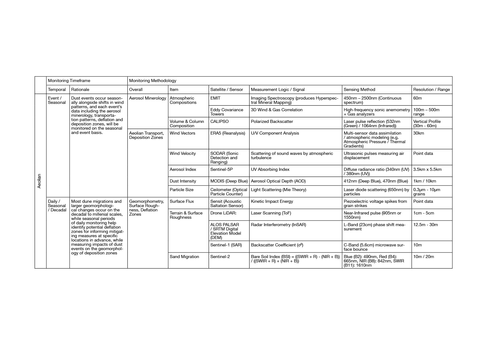
Aeolian
To read the aeolian conditions examines the aerosol minerology, aeolian transportation patterns with associated deflation and deposition zones, geomorphometry, and surface roughness. In addition to previous satellites and sensors, it draws from Eddy Covariance towers, CALIPSO, SODAR, Sentinel 5P, ceilometers, sensit acoustic saltation sensors, LiDARs, and DEMs.
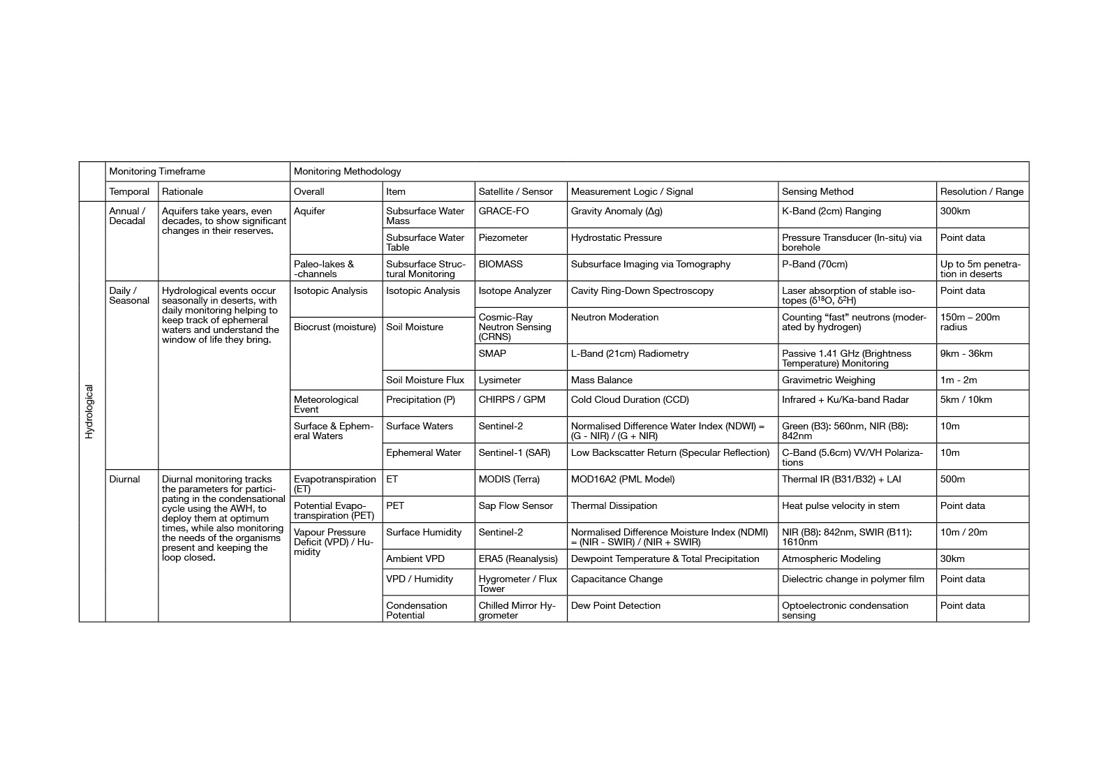
Hydrological
To read the hydrological conditions examines the hydrological cycles at three time-cycles, namely the decadal and annual monitoring of aquifers and paleo-lakes and -channels, the seasonal and event-driven monitoring of isotopic signatures, biocrust moisture, and the water bodies, and the daily and diurnal readings needed for the feedback loop. In addition to previous items, this thus requires the following satellites GRACE-FO, BIOMASS, SMAP, CHIRPS, GPM, as well as sensors such as piezometers, isotope analysers, CRNS, lysimeter systems, sap flow sensors, hygrometers, and dewpoint-detectors.
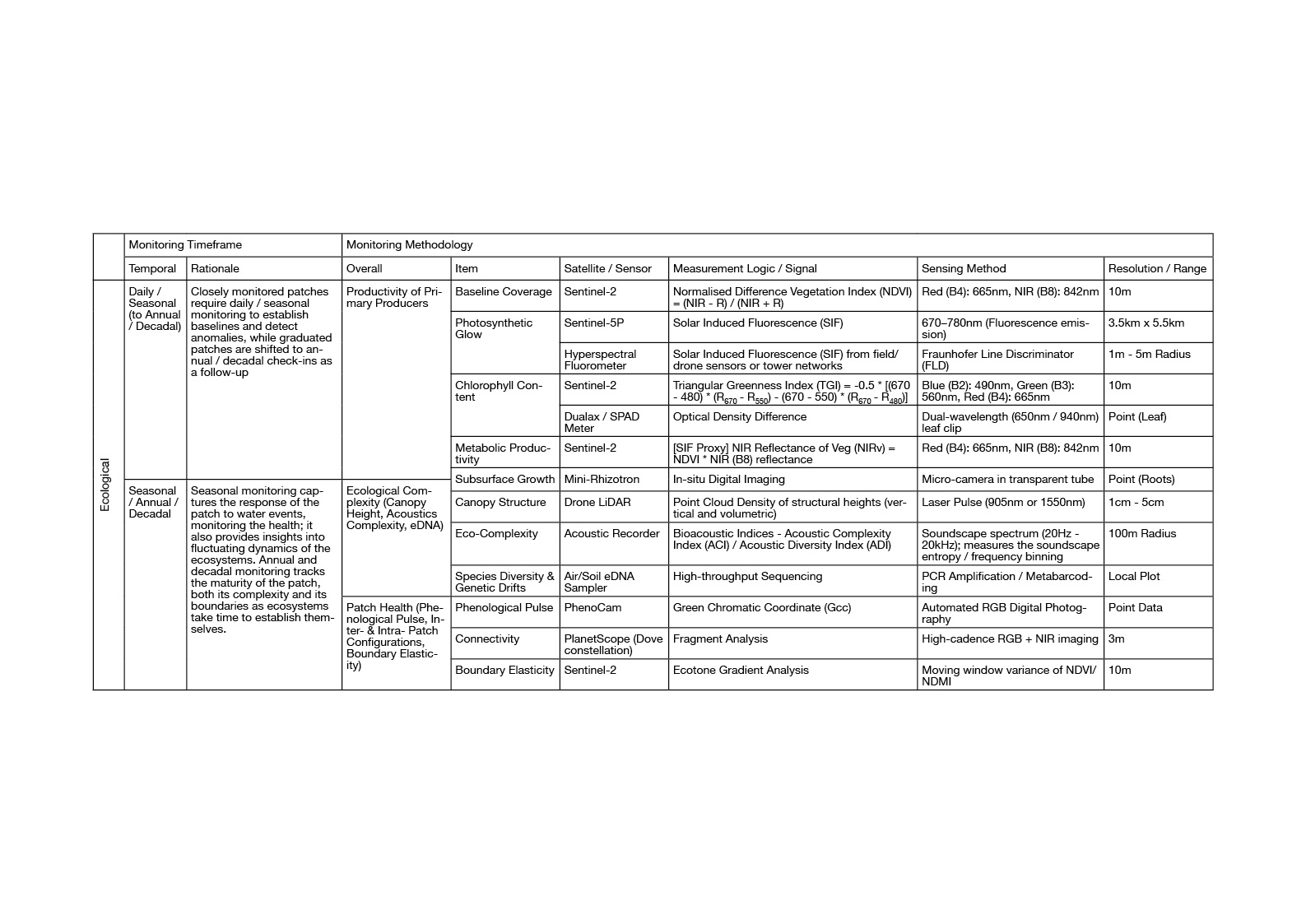
Ecological
To read the ecological conditions monitors the primary producers’ productivities, the ecological complexity of the patch, and its overall health. In addition to previous satellites and sensors, it uses hyperspectral sensors, chlorophyll content indicators, minirhizotron, Biodiversity Indices via acoustic recorders, eDNA, PhenoCam.
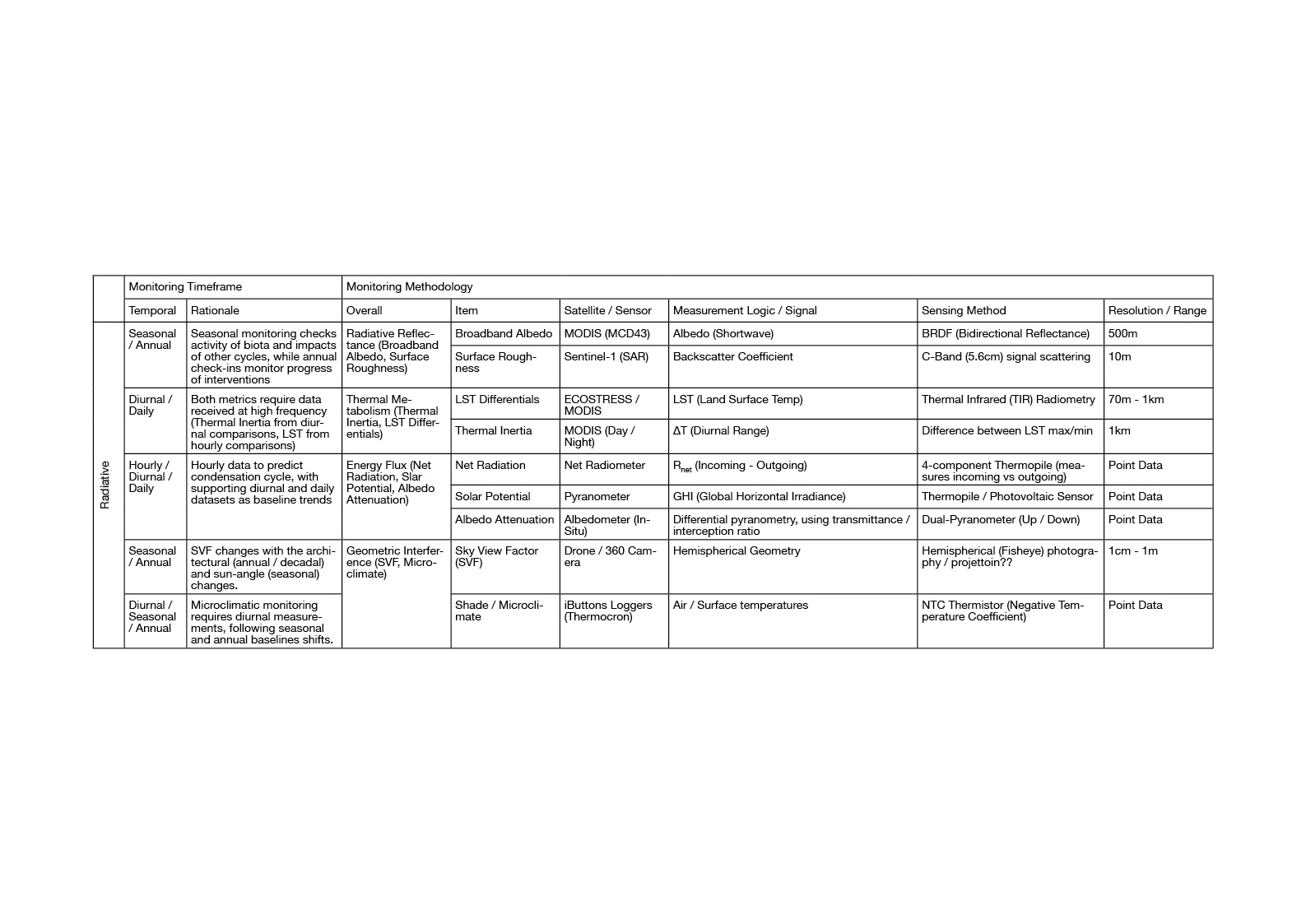
Radiative
To read the radiative conditions looks at radiative reflectance, thermal metabolism, energy flux, and geometric interference. In addition to previous satellites and sensors, it looks at pyranometers and its derivatives (net radiometer, albedometer, etc.), as well as thermocron loggers.
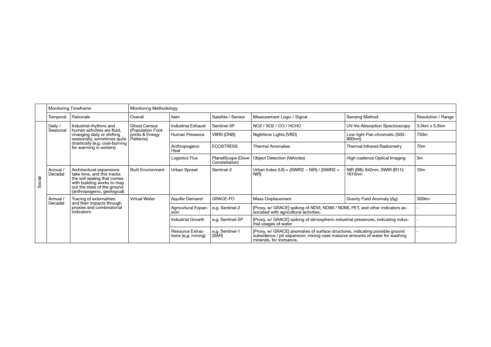
Social
To read the social cycles tracks the built environment expansions, as well as ghost census and virtual water footprints through proxy indicators. This mostly relies on the sensors already introduced, with an addition of the VIIRS for nightlight.